The map is interactive. I think you can get down to the state level by clicking it. This is just a recent screen shot:
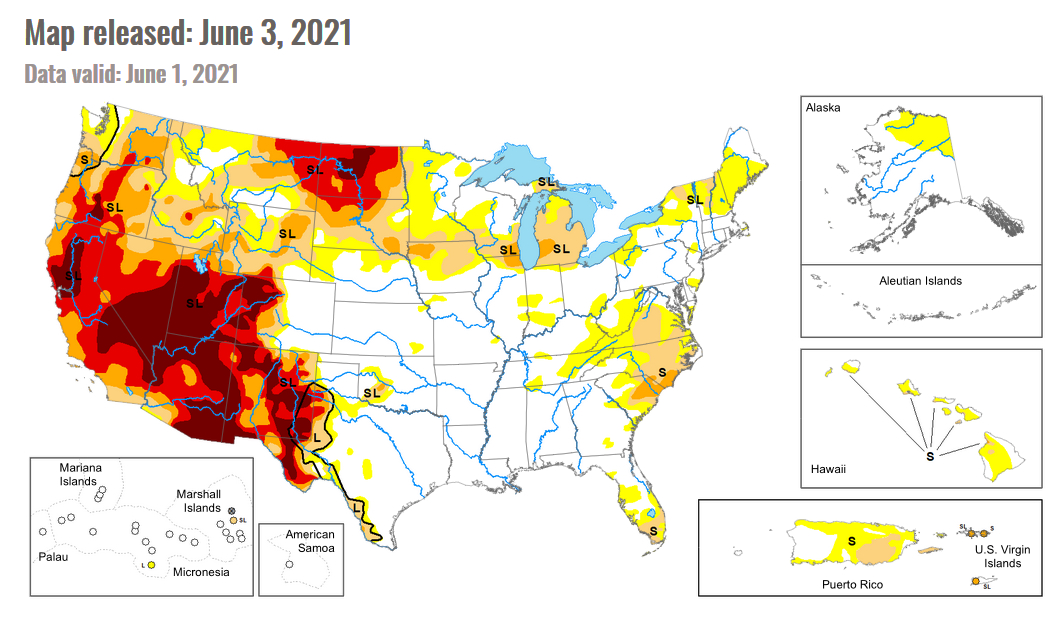
Source: University of Nebraska
The data cutoff for Drought Monitor maps is each Tuesday at 8 a.m. EDT. The maps, which are based on analysis of the data, are released each Thursday at 8:30 a.m. Eastern Time.
Thanks to Bill.